Analyitics

Showing posts with label Block Island. Show all posts

Friday, July 19, 2013

Block Island Running 2013

Block Island is a small island off the coast of Rhode Island that is only accessible by ferry. Perhaps for that reason, it is, in my opinion, the perfect ecosystem; a perfect mix of town, open space (over 43% of the island is protected from development), beach, and shrubland.

On my vacation the last two years, I focused on running on the road or beach. This year, however, I really wanted to take advantage of Block Island’s trails. The Greenway, named after the famous UK walking trails,  consist of ~25 miles of trails that wind all over the island – a lot of coverage for an island that’s only about 10 square miles. Since I knew from previous experience that the trails were not well marked, I spent a lot of time studying the maps before I headed out. I was helped by the fact that our rental home was in the heart of the island right next to a major trail (near Turnip Farm).
Trail Entrance
Block Island trails feel incredibly remote, even when paralleling roads. The only other beings I saw on the trails was one runner, numerous deer (BI has a serious deer overpopulation, countless birds, and an a rooster defending his chicks.

My first outing was a combination of roads and the Fresh Swamp Trail. This served as my introduction to the themes of Block Island trail running: extreme humidity, lots of bugs, rolling terrain, and lots of brush to duck and weave around.

On my second run, I hit the beach around the southwest corner of the island. As you can see, the bluffs are dramatic and served as a nice backdrop as I labored through the sand. I had assumed there would be a trail up the cliffs to the Elizabeth Dickens Trail, but this did not exist, so I had to run to Black Rock Point where I found a path up to what turned out to be Black Rock Road. Unfortunately, there were no markers and I turned left when I should have turned right and ended up hopelessly lost in the meadows.  (It didn't help that I had no GPS signal!) Eventually, I made my way Lewis Farm Road (with a minimum of bushwhacking) which lead me back home. The lesson: verify your beach access points before you start out!

The third run I hit up the Rodman’s Hollow loop, a dramatic basin that's only 20 feet above sea level. Despite laboring up and down some intense hills in massive humidity it was a nice run with a fantastic view north towards the end. Afterwards, I ran down Black Rock Road - a disused dirt road perfect for hiking - and enjoyed the views of the southern part of the island.
Path down to the Beach
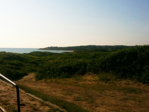
My favorite run was heading north through Turnip Farm past the Island Cemetery and all the way to the Coast Guard Station. These trails were the most poorly marked, mainly because there are a large number of small spur trails. Still, these were perhaps the most fun, and led to at least one amazing view over the airport towards Old Town. These trails were diverse, and mainly went along the stone walls that you see wherever you look.
One of many Stone Walls
As much as I'd like to say I finished off with a bang, by the end of the week the hard living was catching up with me, so my last run was a short a short run to and from Dories Cove for a (extremely cold!) swim. On the way back the trail took me past old Dodge Cemetery which lived in the bushes above our house.

The Trail past Dodge Cemetery
In conclusion, if you find yourself on Block Island, there's no doubt you should explore the trails - they're fun, challenging, and lead you to areas of the island that feel miles away from the hustle and bustle of the town and famous beaches. Just be sure to take along a map and a compass!

Related Posts:

Tuesday, August 7, 2012

Block Island Running

I recently got back from a vacation to Block Island that happily coincided with my return to serious running. You might not think that there are many place to run on Block Island, considering that it's only 10 square miles, but there's a surprising amount of variability in the terrain. This is made even better by the fact that almost half of the island's land is conserved, meaning that there are a lot of open vistas and trails to enjoy.
A rocky path to the beach!

On this vacation, I was still testing out the knee that crapped out in the Burlington Marathon, so I only laced up the shoes three times. The first time was a road loop around the "meat" of the southern part of the island, a pleasant morning run through farmland and the panoramas over Rodman's Hollow. My second run was a quick trip up to Coast Guard and Crescent beach in the heat of the day - really too hot for comfort, despite the sea breezes that normally cool you off - being a pretty narrow island, the winds are prevalent there.
On the way to Coast Guard Beach
My favorite run was my last: a jaunt up Corn Neck Road to BI's northernmost tip.This one has it all: The sky dominating everything. Farms and beach houses everywhere. The red house.The view of the northern point over Sachem Pond. It's here, once you get past the crowds of Crescent Beach, that you really experience Block Island's true isolation. While you can reach it by plane, most come by ferry, meaning that the amount of cars on the island is limited. As such, it's blessedly quiet - no nearby highways! - and the roads, while narrow, are free of cars buzzing by you. Drivers expect a lot of walkers and bikers in the road, and slow down accordingly. This great experience makes for great road running up and down the neck: I'm looking forward to doing this one a few times next year.
A bridge over the backwaters at the narrowest point of the island
I'd recommend Block Island to anyone, runner or not. There are a lot of runs I haven't even mentioned - running on the empty beaches of the west side of the island; the 25 miles of trails - and any run you take is filled with excellent imagery. It's idyllic, really, and I look forward to going back again soon.

Tuesday, July 19, 2011

Island Running


I spent all of last week on Block Island enjoying a vacation. Since it was a vacation, I spent a good chunk of it relaxing and drinking too many beers, so I didn’t lace on the shoes as much as I should have. In fact, most of my runs were just quick .9 mile jaunts to and from the beach for sunset swims. However, I did get out for two nice runs that I’d like to share with you.

My first big run was an attempt at running the island trails. Since a surprisingly large portion of Block Island is conservation land – part of the reason why it’s so damned beautiful – there are a lot of walking/running paths called the "Greenway." Frank and I both found this running challenging: the middle of the island consists of rolling hills, so the running was up and down and side to side - like running through a skateboarding park. It felt isolated – and at times it was – but since BI is only 10 square miles, we were continually surprised the sight of a house or road through a narrow gap of foliage on the side of the trail. Overall, it was fun, and I’d do it again, except for my major complaint: these trails were NOT well marked. Frank had even sprung for the official trail map, but not even that prevented us from getting lost THREE times, and eventually we were forced to make our way over to the airport rather than on the southern part of the island as we had hoped. For that reason alone, I really can’t recommend this run.
But most people go to BI for the beach, and IMO outside of actually running on the beach (and Crescent Beach is the best beach running on the island, as long as you do it early or late in the day), your best bet is to run up and down Corn Neck Road. This road goes from Old Harbor – the only town on the island – all the way up to the island’s northern point. Not only do you start with the incredible view of Crescent Beach curving in and away from you, but you also get to see the “true” BI once you get away from the crowded part of the southern island. Small rolling hills – nothing like what’s in Ashland! – take you into farmland and mansion country, where bucolic scenes meet your every foot strike. Sounds cheesy but it isn’t: the entire journey is a feast for your eyes. After about 3 miles, you start to see the ocean on either side of you as the road curves around Sashem Pond and ends a half-mile before the dramatically isolated North Lighthouse. The beach run to the lighthouse and the peak of the island is a bit rocky but well worth the trip as you get to stand on a narrow spit of land and watch the rip tide. There and back was a mellow 8 mile loop, and I loved every minute of it. I hope to run it again sometime.